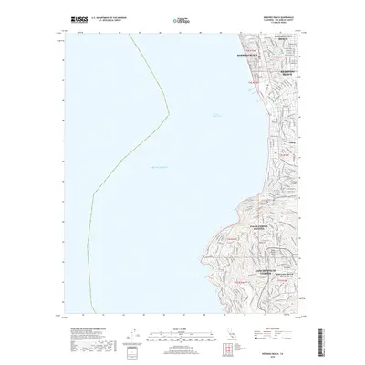
2018 Map of Redondo Beach
USGS Topo · Published 2018About this map
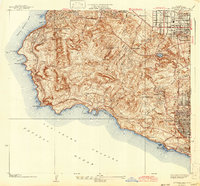
Manhattan Beach, Hermosa Beach, and Redondo Beach form a continuous coastal corridor along the eastern edge of Santa Monica Bay in this 2018 survey. The map details a densely developed grid that transitions from the commercial and residential hubs of the beach cities into the elevated topography of the Palos Verdes Peninsula. This southern portion of the quadrangle is defined by winding residential roads and a network of recreational paths including the Boundary Trail, Valmonte Trail, and Isabel's Trail. The settlement at Clifton and the luxury developments of Palos Verdes Estates and Rancho Palos Verdes illustrate the complex modern land use of the South Bay, where suburban expansion meets the steep rises of the Palos Verdes Hills.
Find a feature on this map
32 named features on this map. Tap any name to fly to it.
Don’t see what you’re looking for? This feature index may not catch every label — zoom into the map to look around manually.
Map Details
Editions of this 2018 Redondo Beach Map
This is the sole edition of this map. No revisions or reprints were ever made.
Other maps of this area

1896 · Redondo
USGS Topo · 1:62,500

1896 · San Pedro
USGS Topo · 1:62,500

1901 · Southern California Sheet No. 1
USGS Topo · 1:250,000

1904 · Southern California Sheet No. 1
USGS Topo · 1:250,000

1924 · Torrance
USGS Topo · 1:24,000
1925 · San Pedro Hills
USGS Topo · 1:24,000
1928 · San Pedro Hills
USGS Topo · 1:24,000
1934 · Torrance
USGS Topo · 1:24,000
1942 · San Pedro Hill
USGS Topo · 1:24,000

1943 · San Pedro
USGS Topo · 1:125,000