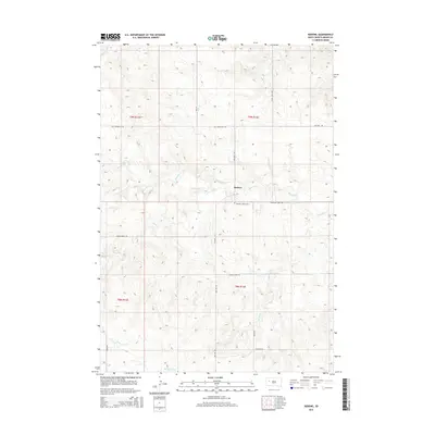
2015 Map of Redowl
USGS Topo · Published 2015About this map
Redowl sits at the heart of this Meade County landscape, where the high plains of South Dakota are defined by a network of seasonal watercourses. The drainage patterns of Red Owl Cr, Indian Cr, and Spring Cr create a complex topography across the townships of T9N R12E and T8N R13E. Notable local landmarks like the Pleasant Valley Cem south of the settlement provide touchpoints for genealogists and local historians. The road network, including historical routes like Old Stoneville Rd and Pleasant View Rd, reflects the rural agricultural character of the region. In the southern portion of the map, the terrain descends toward the drainage of White Owl Cr, illustrating the subtle but important elevation changes that dictate land use in this western prairie environment.
Find a feature on this map
22 named features on this map. Tap any name to fly to it.
Don’t see what you’re looking for? This feature index may not catch every label — zoom into the map to look around manually.
Map Details
Editions of this 2015 Redowl Map
This is the sole edition of this map. No revisions or reprints were ever made.
Other maps of this area

1953 · Rapid City
USGS Topo · 1:250,000

1957 · Rapid City
USGS Topo · 1:250,000

1959 · Enning
USGS Topo · 1:24,000

1959 · Redowl
USGS Topo · 1:24,000

1959 · Stoneville
USGS Topo · 1:24,000

1959 · Union Center
USGS Topo · 1:24,000

1983 · Whiteman Owl NW
USGS Topo · 1:24,000

1983 · Opal West SE
USGS Topo · 1:24,000

1983 · Whiteman Owl
USGS Topo · 1:24,000

1983 · Opal East SW
USGS Topo · 1:24,000