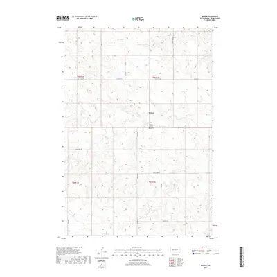
2017 Map of Redowl
USGS Topo · Published 2017About this map
Redowl serves as the central point of this West River landscape, situated among the drainage basins of several significant local waterways. The topography is defined by the winding paths of Red Owl Cr and Elm Cr, which cut through the high plains terrain. Local history is anchored by the presence of the Pleasant View Red Owl Cem and the Pleasant Valley Cem, providing essential markers for genealogists and researchers tracking family roots in Meade County. The road network, including Co HWY MC-26 and Red Owl Rd, follows the section lines of the Public Land Survey System, illustrating the orderly division of the South Dakota prairie. The map captures the interface between the upper reaches of Indian Cr and Spring Cr, reflecting the vital role of water distribution in this ranching country.
Find a feature on this map
22 named features on this map. Tap any name to fly to it.
Don’t see what you’re looking for? This feature index may not catch every label — zoom into the map to look around manually.
Map Details
Editions of this 2017 Redowl Map
This is the sole edition of this map. No revisions or reprints were ever made.
Other maps of this area

1953 · Rapid City
USGS Topo · 1:250,000

1957 · Rapid City
USGS Topo · 1:250,000

1959 · Enning
USGS Topo · 1:24,000

1959 · Redowl
USGS Topo · 1:24,000

1959 · Stoneville
USGS Topo · 1:24,000

1959 · Union Center
USGS Topo · 1:24,000

1983 · Whiteman Owl NW
USGS Topo · 1:24,000

1983 · Opal West SE
USGS Topo · 1:24,000

1983 · Whiteman Owl
USGS Topo · 1:24,000

1983 · Opal East SW
USGS Topo · 1:24,000