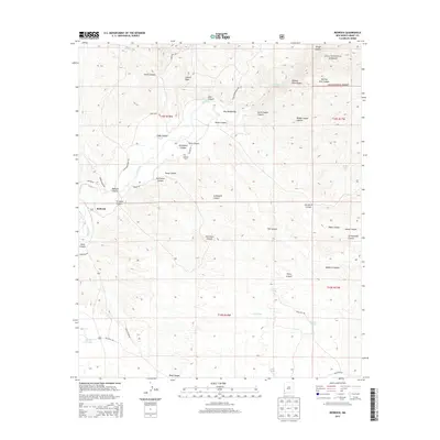
2013 Map of Redrock
USGS Topo · Published 2013About this map
Redrock serves as the primary settlement hub in this part of Grant County, where the desert landscape is deeply carved by the Gila River. The river's path through the Gila Middle Box and its surrounding canyons, such as Starvation Canyon and Graveyard Canyon, indicates a terrain defined by dramatic drainage systems and high points like Lydian Peak. Human presence is evidenced by a network of ranch and department roads, including Conner Rd and Patton Rd, which navigate the various draws and canyons.
Find a feature on this map
45 named features on this map. Tap any name to fly to it.
Don’t see what you’re looking for? This feature index may not catch every label — zoom into the map to look around manually.
Map Details
Editions of this 2013 Redrock Map
This is the sole edition of this map. No revisions or reprints were ever made.
Other maps of this area

1954 · Silver City
USGS Topo · 1:250,000

1958 · Silver City
USGS Topo · 1:250,000

1959 · Steeple Rock
USGS Topo · 1:62,500

1959 · Redrock
USGS Topo · 1:62,500

1959 · Canador Peak
USGS Topo · 1:62,500

1959 · Cliff
USGS Topo · 1:62,500

1962 · Silver City
USGS Topo · 1:250,000
1990 · Willow Draw
USGS Topo · 1:24,000
1990 · Eagle Eye Peak
USGS Topo · 1:24,000
1990 · Bullard Peak
USGS Topo · 1:24,000