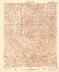
1936 Map of Redrock Mtn.
USGS Topo · Published 1936About this map
The Angeles National Forest dominates this mid-1930s landscape, centered on the heights of Redrock Mtn. This survey captures the vital infrastructure of the era, from the winding Ridge Route to the extensive Telephone Line and various fire-prevention features like the Firebreak and Fire Line. Human activity in these mountains is reflected in small outposts such as Kelly Ranch and Naylor Place, while the 1920s-era Shelter House and Cienaga Camp provided essential stopovers in the backcountry. The map also documents the Gillette Mine, a testament to local extraction efforts. Geologically, the terrain is defined by a complex network of drainages including Castaic Creek, Fish Canyon, and Cienaga Canyon, which carve through the high elevations of Liebre Mountain and Red Mountain.
Find a feature on this map
25 named features on this map. Tap any name to fly to it.
Don’t see what you’re looking for? This feature index may not catch every label — zoom into the map to look around manually.
Map Details
Editions of this 1936 Redrock Mtn. Map
3 editions found
Other maps of this area

1903 · Tejon
USGS Topo · 1:125,000

1931 · Red Mountain
USGS Topo · 1:24,000

1931 · Whitaker Peak
USGS Topo · 1:24,000

1931 · Warm Spring
USGS Topo · 1:24,000

1931 · Redrock Mtn
USGS Topo · 1:24,000

1932 · Beartrap Canyon
USGS Topo · 1:24,000

1932 · Neenach
USGS Topo · 1:24,000

1933 · Manzana
USGS Topo · 1:24,000

1933 · Quail
USGS Topo · 1:24,000

1935 · Whitaker Peak
USGS Topo · 1:24,000