
1935 Map of Whitaker Peak
USGS Topo · Published 1935About this map
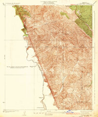
Whitaker Peak stands at the center of this 1930s survey of the rugged mountainous divide between Los Angeles and Ventura counties. The landscape is dominated by the overlapping boundaries of the Santa Barbara National Forest and the Angeles National Forest, reflecting an era of federal land management and early recreational development. Along the southwestern drainage of Piru Creek, remote outposts like Agua Blanca Camp and Slayback Camp provide evidence of early forest service activity and backcountry access. On the northern edge, Highway No 99 cuts through the terrain near the Oak Flat Playground, a municipal site managed by Los Angeles City. The drainage patterns of Canton Canyon and Ruby Canyon illustrate the complex watershed that defines this portion of the Transverse Ranges before later regional development.
Find a feature on this map
16 named features on this map. Tap any name to fly to it.
Don’t see what you’re looking for? This feature index may not catch every label — zoom into the map to look around manually.
Map Details
Editions of this 1935 Whitaker Peak Map
4 editions found
Other maps of this area

1900 · Piru
USGS Topo · 1:62,500

1903 · Tejon
USGS Topo · 1:125,000

1903 · Camulos
USGS Topo · 1:125,000

1903 · Santa Susana
USGS Topo · 1:62,500

1921 · Piru
USGS Topo · 1:62,500

1931 · Whitaker Peak
USGS Topo · 1:24,000

1931 · Santa Felicia Canyon
USGS Topo · 1:24,000

1931 · Castaic
USGS Topo · 1:24,000

1931 · Redrock Mtn
USGS Topo · 1:24,000

1932 · Beartrap Canyon
USGS Topo · 1:24,000