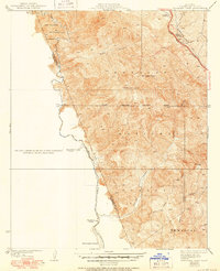
1935 Map of Whitaker Peak
USGS Topo · Published 1951About this map
Piru Creek carves a deep path through the transition between Los Padres National Forest and Angeles National Forest in this mid-century survey of northern Los Angeles County. The map documents the early infrastructure of the region, anchored by the Golden State Highway as it winds along the eastern edge near Fisher Spring. This era was characterized by a reliance on fire suppression and forestry management, evidenced by the strategic placement of the Whitaker Peak Lookout and the Oak Flat Guard Sta.
Find a feature on this map
20 named features on this map. Tap any name to fly to it.
Don’t see what you’re looking for? This feature index may not catch every label — zoom into the map to look around manually.
Map Details
Editions of this 1935 Whitaker Peak Map
4 editions found

Other maps of this area

1900 · Piru
USGS Topo · 1:62,500

1903 · Tejon
USGS Topo · 1:125,000

1903 · Camulos
USGS Topo · 1:125,000

1903 · Santa Susana
USGS Topo · 1:62,500

1921 · Piru
USGS Topo · 1:62,500

1931 · Whitaker Peak
USGS Topo · 1:24,000

1931 · Santa Felicia Canyon
USGS Topo · 1:24,000

1931 · Castaic
USGS Topo · 1:24,000

1931 · Redrock Mtn
USGS Topo · 1:24,000

1932 · Beartrap Canyon
USGS Topo · 1:24,000