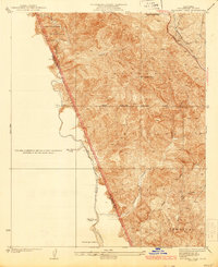
1935 Map of Whitaker Peak
USGS Topo · Published 1935About this map
Whitaker Peak dominates this mountainous 1930s landscape, where the sheer density of contour lines reveals the sharp verticality of the northern Transverse Ranges. This survey by Alfred Jones and the Los Angeles County Board of Supervisors captures the rugged divide between Los Angeles and Ventura Counties. The storied Ridge Route Highway snakes across the northeastern ridges, serving as the primary inland link for motor travel through these canyons before modern interstate alignments. Below the peaks, remote outposts like Agua Blanca Camp and Slayback Camp sit along the winding course of Piru Creek. The map documents a wilderness transition, showing the boundary where the Santa Barbara National Forest meets the Angeles National Forest, with the Piru Ranger Station providing a lone point of institutional presence in the south.
Find a feature on this map
14 named features on this map. Tap any name to fly to it.
Don’t see what you’re looking for? This feature index may not catch every label — zoom into the map to look around manually.
Map Details
Editions of this 1935 Whitaker Peak Map
4 editions found

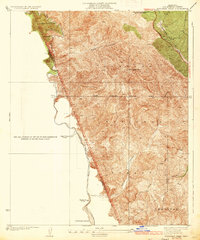
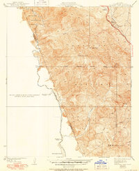
Other maps of this area

1900 · Piru
USGS Topo · 1:62,500

1903 · Tejon
USGS Topo · 1:125,000

1903 · Camulos
USGS Topo · 1:125,000

1903 · Santa Susana
USGS Topo · 1:62,500

1921 · Piru
USGS Topo · 1:62,500

1931 · Whitaker Peak
USGS Topo · 1:24,000

1931 · Santa Felicia Canyon
USGS Topo · 1:24,000

1931 · Castaic
USGS Topo · 1:24,000

1931 · Redrock Mtn
USGS Topo · 1:24,000

1932 · Beartrap Canyon
USGS Topo · 1:24,000