
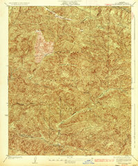
1931 Map of Redrock Mtn
USGS Topo · Published 1931About this map
The Angeles National Forest dominates this 1931 survey, revealing a landscape defined by rugged canyons and early forestry infrastructure. This era of forest management is highlighted by the presence of a Shelter House and a prominently marked Firebreak cutting across the terrain. Human activity in the backcountry is evidenced by the Old Gillette Mine and the Kelly Ranch, while the Emergency Airplane Landing Field underscores the transition into the aviation age for mountain patrolling and rescue operations.
Find a feature on this map
19 named features on this map. Tap any name to fly to it.
Don’t see what you’re looking for? This feature index may not catch every label — zoom into the map to look around manually.
Map Details
Editions of this 1931 Redrock Mtn Map
This is the sole edition of this map. No revisions or reprints were ever made.
Other maps of this area

1903 · Tejon
USGS Topo · 1:125,000

1931 · Red Mountain
USGS Topo · 1:24,000

1931 · Whitaker Peak
USGS Topo · 1:24,000

1931 · Warm Spring
USGS Topo · 1:24,000

1932 · Beartrap Canyon
USGS Topo · 1:24,000

1932 · Neenach
USGS Topo · 1:24,000

1933 · Manzana
USGS Topo · 1:24,000

1933 · Quail
USGS Topo · 1:24,000

1935 · Whitaker Peak
USGS Topo · 1:24,000
1936 · Warm Spring
USGS Topo · 1:24,000