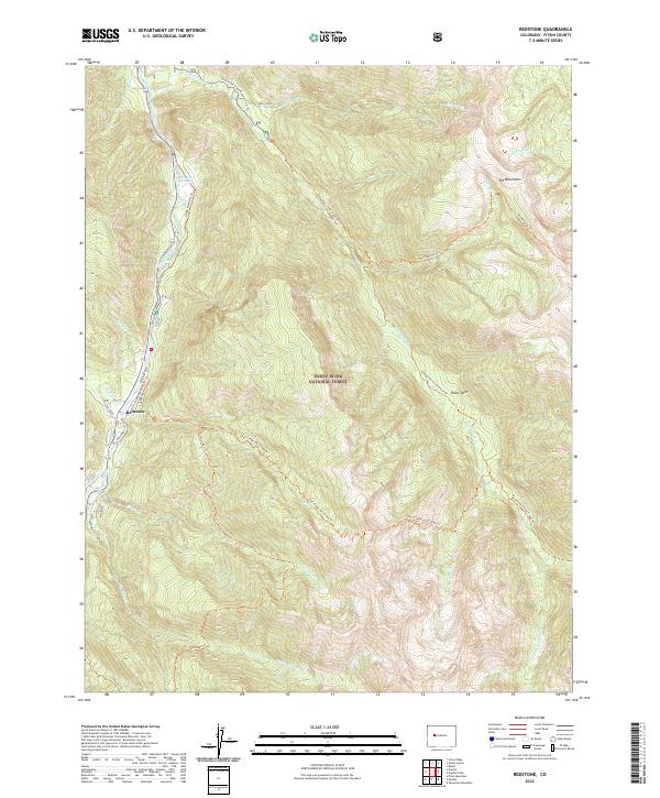
2022 Map of Redstone
USGS Topo · Published 2022About this map
Redstone sits within the high-elevation terrain of the White River National Forest, where the Crystal River valley carves through the Elk Mountains. This 2022 survey captures the modern road and trail infrastructure that defines the region, including Redstone Blvd and the historic approach along Redstone Castle Dr. The landscape is a mix of protected wilderness and specialized recreation, with the Filoha Meadows Trl and Avalanche Creek Road X-C Ski Trl providing access to the more remote peaks.
Find a feature on this map
37 named features on this map. Tap any name to fly to it.
Don’t see what you’re looking for? This feature index may not catch every label — zoom into the map to look around manually.
Map Details
Editions of this 2022 Redstone Map
This is the sole edition of this map. No revisions or reprints were ever made.
Other maps of this area

1957 · Leadville
USGS Topo · 1:250,000

1959 · Leadville
USGS Topo · 1:250,000

1960 · Leadville
USGS Topo · 1:250,000

1960 · Marble
USGS Topo · 1:24,000

1960 · Capitol Peak
USGS Topo · 1:24,000

1960 · Redstone
USGS Topo · 1:24,000
1960 · Snowmass Mountain
USGS Topo · 1:24,000

1961 · Mount Sopris
USGS Topo · 1:24,000

1961 · Basalt
USGS Topo · 1:24,000

1962 · Leadville
USGS Topo · 1:250,000