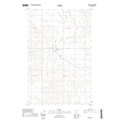
2020 Map of Redstone
USGS Topo · Published 2020About this map
Redstone sits at the intersection of rural life and the expansive northern plains landscape of Sheridan County. This 2020 layout reveals a community defined by its watercourses, most notably the winding path of Big Muddy Cr and its tributaries like Redstone Cr and Whitetail Creek to the north. The presence of both Old Redstone Cem and the Valleyview Cem suggests a long-standing settlement history, serving generations of farming families across the surrounding townships. Locally significant roads such as Daleview Rd, Bergh Rd, and Main St form the framework for this high-plains agricultural area, connecting disparate homesteads to the central village. The topography is marked by the branching forks of Eagle Cr, including the N Fork Eagle Cr and Middle Fork Eagle Cr, which create natural drainage patterns across the rolling terrain.
Find a feature on this map
18 named features on this map. Tap any name to fly to it.
Don’t see what you’re looking for? This feature index may not catch every label — zoom into the map to look around manually.
Map Details
Editions of this 2020 Redstone Map
This is the sole edition of this map. No revisions or reprints were ever made.
Other maps of this area

1954 · Wolf Point
USGS Topo · 1:250,000

1958 · Wolf Point
USGS Topo · 1:250,000

1973 · Navajo
USGS Topo · 1:24,000

1973 · Goodale Coulee
USGS Topo · 1:24,000

1973 · Pleasant Prairie NE
USGS Topo · 1:24,000
1983 · Daleview
USGS Topo · 1:24,000

1983 · Outlook
USGS Topo · 1:24,000

1983 · Redstone
USGS Topo · 1:24,000

1983 · Soo NW
USGS Topo · 1:24,000

1983 · Archer
USGS Topo · 1:24,000