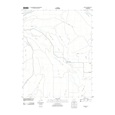
2010 Map of Redvale
USGS Topo · Published 2010About this map
Wrights Mesa defines the high ground of this West Slope landscape, where the settlement of Redvale sits at the junction of several county roads. The area's history of resource extraction is evident in the cluster of mining operations near the town center, specifically the Klondyke Mine and Johnstown Mine. To the east, the community of Coventry is established near the Coventry Cemetery, overlooking the deep incision of Naturita Canyon.
Find a feature on this map
36 named features on this map. Tap any name to fly to it.
Don’t see what you’re looking for? This feature index may not catch every label — zoom into the map to look around manually.
Map Details
Editions of this 2010 Redvale Map
This is the sole edition of this map. No revisions or reprints were ever made.
Other maps of this area

1916 · Paradox Valley
USGS Topo · 1:125,000

1922 · Paradox Valley
USGS Topo · 1:125,000

1956 · Moab
USGS Topo · 1:250,000

1959 · Moab
USGS Topo · 1:250,000

1960 · Moab
USGS Topo · 1:250,000
1960 · Nucla
USGS Topo · 1:24,000
1960 · Nucla
USGS Topo · 1:62,500

1962 · Moab
USGS Topo · 1:250,000

1964 · Moab
USGS Topo · 1:250,000
1964 · Basin
USGS Topo · 1:24,000