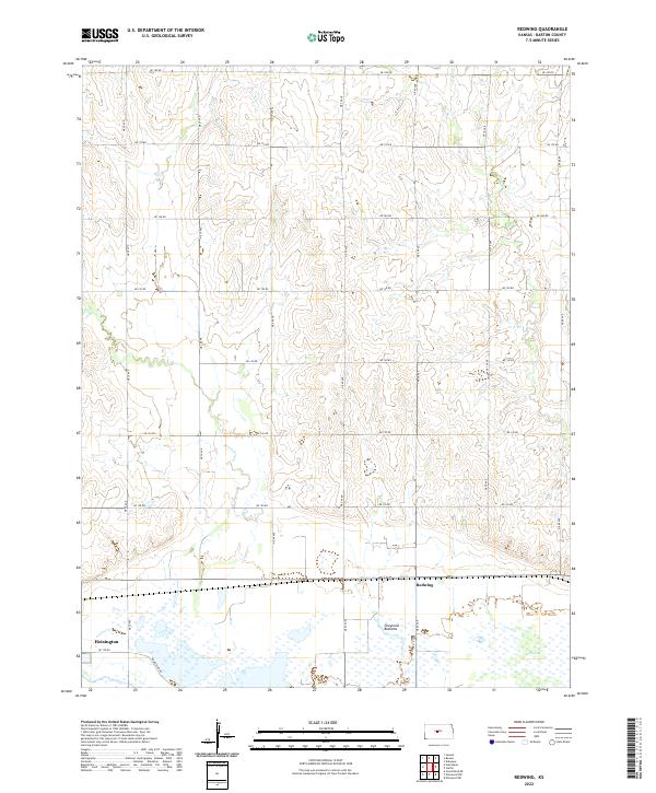
2022 Map of Redwing
USGS Topo · Published 2022About this map
Cheyenne Bottoms dominates the southern landscape of this Barton County region, revealing a complex network of wetlands and managed water including Pool 3B. The terrain is characterized by the transition from the marshy lowlands of the basin to the rolling uplands dissected by Cow Cr and Deception Cr. The settlement of Redwing sits at a crossroads just north of the wetlands, while the edge of Hoisington appears in the southwestern corner, anchored by NE 100 Rd and Homestead Rd. This 2022 survey illustrates the modern grid of the Public Land Survey System, with roads like NE 180 Rd and NE 80 Ave defining the agricultural sections. The map serves as a precise record of contemporary water management and land division in a critical Kansas ecological zone.
Find a feature on this map
28 named features on this map. Tap any name to fly to it.
Don’t see what you’re looking for? This feature index may not catch every label — zoom into the map to look around manually.
Map Details
Editions of this 2022 Redwing Map
This is the sole edition of this map. No revisions or reprints were ever made.
Other maps of this area

1891 · Great Bend
USGS Topo · 1:125,000

1893 · Great Bend
USGS Topo · 1:125,000

1896 · Russell
USGS Topo · 1:125,000

1955 · Great Bend
USGS Topo · 1:250,000

1956 · Ellinwood NE
USGS Topo · 1:24,000

1956 · Ellinwood NW
USGS Topo · 1:24,000

1957 · Great Bend
USGS Topo · 1:250,000

1958 · Great Bend
USGS Topo · 1:250,000

1959 · Great Bend NE
USGS Topo · 1:24,000
1969 · Claflin
USGS Topo · 1:24,000