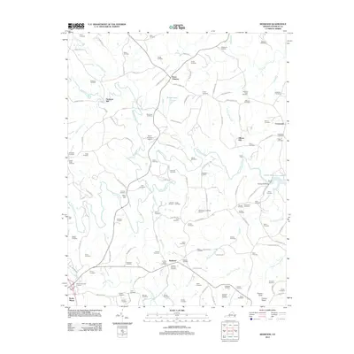
2012 Map of Redwood
USGS Topo · Published 2012About this map
Burnt Chimney and the surrounding Franklin County countryside appear here in a transition toward the modern era, where established mill sites and family lands meet emerging residential development. The landscape is defined by the winding course of the Blackwater River and several of its tributaries, including Maggodee Creek and Foul Ground Creek. Historical industry is represented by Piedmont Mill and Dillons Mill, reflecting a traditional water-powered economy that once anchored these rural communities. To the east, the map captures the western reaches of Smith Mountain Lake, a massive reservoir that reshaped the local geography. Numerous small family cemeteries, such as the Mitchell-Skinnell Cemetery and Wray-Greenwood Cemetery, are scattered across the terrain, offering significant points of interest for genealogists tracing the legacy of the Redwood and Flint Hill settlements. The area's topography rises toward the south, culminating in the prominent height of Preston Knob.
Find a feature on this map
126 named features on this map. Tap any name to fly to it.
Don’t see what you’re looking for? This feature index may not catch every label — zoom into the map to look around manually.
Map Details
Editions of this 2012 Redwood Map
This is the sole edition of this map. No revisions or reprints were ever made.
Other maps of this area

1890 · Roanoke
USGS Topo · 1:125,000

1891 · Roanoke
USGS Topo · 1:125,000

1922 · Callands
USGS Topo · 1:48,000

1924 · Callands
USGS Topo · 1:62,500

1925 · Rocky Mount
USGS Topo · 1:48,000

1927 · Rocky Mount
USGS Topo · 1:62,500

1944 · Rocky Mount
USGS Topo · 1:62,500

1944 · Callands
USGS Topo · 1:62,500

1947 · Roanoke
USGS Topo · 1:250,000

1951 · Boones Mill
USGS Topo · 1:62,500