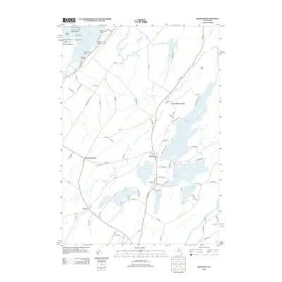
2013 Map of Redwood
USGS Topo · Published 2013About this map
Redwood and Plessis anchor this survey of the lake-studded landscape of Jefferson County, where the Indian River flows through a complex geography of water and island. The map details a dense network of inland lakes including Butterfield Lake, Millsite Lake, Sixberry Lake, and Clear Lake, illustrating the unique hydrology of the North Country. To the northwest, the map reaches the shoreline of Goose Bay on the St. Lawrence, identifying numerous small islands such as Wintergreen Island and Caprice Island. Genealogists and local historians can trace family roots through several dedicated burial grounds, including Redwood Cem, Hill Cem, Barnes Cem, and McDonald Cem. Small settlements like Browns Corners and Bean Hill Crossing appear alongside established roads like Barnes Settlement Rd, reflecting generations of rural development and land use.
Find a feature on this map
99 named features on this map. Tap any name to fly to it.
Don’t see what you’re looking for? This feature index may not catch every label — zoom into the map to look around manually.
Map Details
Editions of this 2013 Redwood Map
This is the sole edition of this map. No revisions or reprints were ever made.
Other maps of this area

1903 · Alexandria Bay
USGS Topo · 1:62,500

1903 · Theresa
USGS Topo · 1:62,500

1911 · Antwerp
USGS Topo · 1:62,500

1912 · Hammond
USGS Topo · 1:62,500

1943 · Redwood
USGS Topo · 1:31,680

1943 · Lafargeville
USGS Topo · 1:31,680

1943 · Alexandria Bay
USGS Topo · 1:31,680

1944 · Hammond
USGS Topo · 1:62,500

1948 · Theresa
USGS Topo · 1:24,000

1948 · Chippewa Bay
USGS Topo · 1:24,000