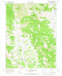
1960 Map of Redwood Valley
USGS Topo · Published 1966About this map
The Russian River and its tributaries define the landscape of this Mendocino County valley during the early 1960s. The Northwestern Pacific railroad corridor serves as the primary industrial artery, passing through the core of Redwood Valley and south toward Calpella. This survey captures the distinct cultural geography of the region, featuring both the Redwood Valley Rancheria and the Potter Valley Rancheria.
Find a feature on this map
47 named features on this map. Tap any name to fly to it.
Don’t see what you’re looking for? This feature index may not catch every label — zoom into the map to look around manually.
Map Details
Editions of this 1960 Redwood Valley Map
3 editions found
Other maps of this area

1920 · Ukiah
USGS Topo · 1:62,500

1922 · Willits
USGS Topo · 1:62,500

1942 · Willits
USGS Topo · 1:62,500

1943 · Pomo
USGS Topo · 1:62,500

1943 · Boonville
USGS Topo · 1:62,500

1944 · Ukiah
USGS Topo · 1:62,500

1944 · Willits
USGS Topo · 1:62,500

1957 · Ukiah
USGS Topo · 1:250,000

1958 · Ukiah
USGS Topo · 1:24,000

1958 · Cow Mountain
USGS Topo · 1:24,000