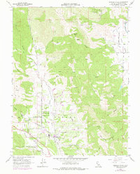
1960 Map of Redwood Valley
USGS Topo · Published 1978About this map
The Russian River corridor defines this portion of Mendocino County, where the valley floor transitions into the steep drainages of Mariposa Creek, Fisher Creek, and Williams Creek. The settlement of Redwood Valley serves as a central hub, supported by the Northwestern Pacific railroad line and a network of rural routes like Salt Hollow Road. The map documents significant cultural and utility infrastructure, including the Redwood Valley Rancheria, a local School, and a prominent Powerhouse near the Potter Valley Canal.
Find a feature on this map
33 named features on this map. Tap any name to fly to it.
Don’t see what you’re looking for? This feature index may not catch every label — zoom into the map to look around manually.
Map Details
Editions of this 1960 Redwood Valley Map
3 editions found
Other maps of this area

1920 · Ukiah
USGS Topo · 1:62,500

1922 · Willits
USGS Topo · 1:62,500

1942 · Willits
USGS Topo · 1:62,500

1943 · Pomo
USGS Topo · 1:62,500

1943 · Boonville
USGS Topo · 1:62,500

1944 · Ukiah
USGS Topo · 1:62,500

1944 · Willits
USGS Topo · 1:62,500

1957 · Ukiah
USGS Topo · 1:250,000

1958 · Ukiah
USGS Topo · 1:24,000

1958 · Cow Mountain
USGS Topo · 1:24,000