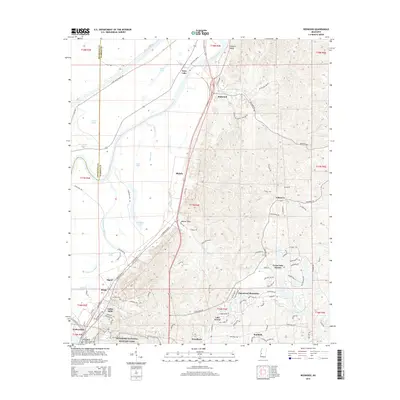
2015 Map of Redwood
USGS Topo · Published 2015About this map
Vicksburg National Military Park occupies the southwestern portion of this landscape, where the ridges and ravines overlooking the Yazoo River floodplain reveal the complex topography that shaped the region's military and civil history. The alluvial plain to the west is defined by a series of oxbow lakes and drainages, including Twin Lake, Goose Lake, and Chickasaw Bayou, which transition abruptly into the steep bluffs of the loess hills. At Redwood, the confluence of the Yazoo River and Skilikalia Bayou marks a historic gateway to the delta. Modern residential developments like Openwood Plantation and Great Lake Estates are situated among the older rural settlements of Blakely and Walnut Hills. This digital-era survey provides a precise view of the interface between the preserved hallowed ground of the military park and the growing suburban communities of Warren County.
Find a feature on this map
101 named features on this map. Tap any name to fly to it.
Don’t see what you’re looking for? This feature index may not catch every label — zoom into the map to look around manually.
Map Details
Editions of this 2015 Redwood Map
This is the sole edition of this map. No revisions or reprints were ever made.
Other maps of this area

1918 · Vicksburg
USGS Topo · 1:62,500

1938 · Edwards
USGS Topo · 1:62,500

1939 · Onward
USGS Topo · 1:62,500

1940 · Mechanicsburg
USGS Topo · 1:62,500

1941 · Vicksburg
USGS Topo · 1:62,500

1955 · Jackson
USGS Topo · 1:250,000

1961 · Jackson
USGS Topo · 1:250,000

1962 · Jackson
USGS Topo · 1:250,000

1962 · Redwood
USGS Topo · 1:24,000

1962 · Vicksburg West
USGS Topo · 1:24,000