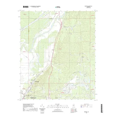
2020 Map of Redwood
USGS Topo · Published 2020About this map
The Yazoo River defines the western corridor of this region north of Vicksburg, where the landscape transitions from the delta lowlands to the elevated terrain of Walnut Hills. Significant for its Civil War history, the southern portion of the sheet encompasses a segment of the Vicksburg National Military Park, while the historic high ground at Snyders Bluff overlooks the river's winding path. The intricate drainage network of Chickasaw Bayou and various oxbow lakes, including Horseshoe Lake and Taylor Lake, illustrates the dynamic nature of the Mississippi floodplain.
Find a feature on this map
99 named features on this map. Tap any name to fly to it.
Don’t see what you’re looking for? This feature index may not catch every label — zoom into the map to look around manually.
Map Details
Editions of this 2020 Redwood Map
This is the sole edition of this map. No revisions or reprints were ever made.
Other maps of this area

1918 · Vicksburg
USGS Topo · 1:62,500

1938 · Edwards
USGS Topo · 1:62,500

1939 · Onward
USGS Topo · 1:62,500

1940 · Mechanicsburg
USGS Topo · 1:62,500

1941 · Vicksburg
USGS Topo · 1:62,500

1955 · Jackson
USGS Topo · 1:250,000

1961 · Jackson
USGS Topo · 1:250,000

1962 · Jackson
USGS Topo · 1:250,000

1962 · Redwood
USGS Topo · 1:24,000

1962 · Vicksburg West
USGS Topo · 1:24,000