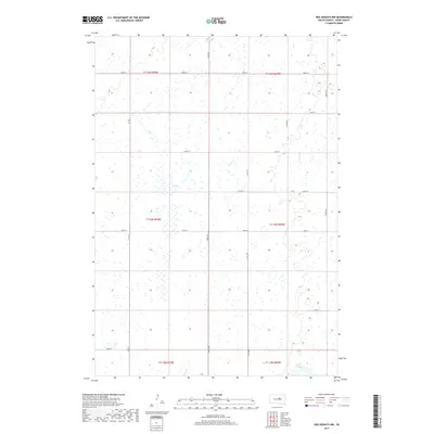
2017 Map of Ree Heights NW
USGS Topo · Published 2017About this map
Lake Louise anchors the southeastern corner of this central South Dakota landscape, providing a rare permanent water feature in a region defined by its seasonal drainages and prairie potholes. The land is etched by the meandering paths of Lost Cr and Wolf Cr, which wind through the township and range divisions of Hand County. This 2017 survey reveals the persistent grid of the Public Land Survey System, where section lines are traced by local routes like 350th Ave and 183rd St. The area's character is purely agricultural and rural, with the vast majority of the terrain dedicated to open fields and wetlands. Larger regional connectors like Co Rd 3 and Co Rd 17 facilitate movement across this sparsely populated section of the Great Plains, where the drainage patterns of the creeks dictate the subtle contours of the local topography.
Find a feature on this map
21 named features on this map. Tap any name to fly to it.
Don’t see what you’re looking for? This feature index may not catch every label — zoom into the map to look around manually.
Map Details
Editions of this 2017 Ree Heights NW Map
This is the sole edition of this map. No revisions or reprints were ever made.
Other maps of this area

1949 · Ree Heights NW
USGS Topo · 1:24,000

1950 · Ree Heights SE
USGS Topo · 1:24,000

1950 · Highmore NE
USGS Topo · 1:24,000

1950 · Ree Heights
USGS Topo · 1:24,000

1950 · Highmore SE
USGS Topo · 1:24,000

1950 · Rezac Lake
USGS Topo · 1:24,000

1951 · Ree Heights NW
USGS Topo · 1:24,000

1951 · Orient SW
USGS Topo · 1:24,000

1951 · Rezac Lake
USGS Topo · 1:24,000

1951 · Polo
USGS Topo · 1:24,000