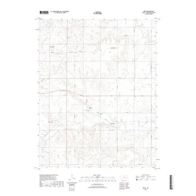
2018 Map of Reece
USGS Topo · Published 2018About this map
Reece sits as the central settlement in this portion of Greenwood County, oriented along West St and the southern edge of Old US Hwy 54. The surrounding landscape is defined by an intricate drainage system, where the West Branch Fall River meanders through the northeast while tributaries like Burnt Creek, Coon Creek, and Spring Creek carve the upland prairie. This rural geography is heavily influenced by the township and range system, with a rigid grid of local routes such as Twp Rd 35 and Twp Rd 349 providing access to the various sections. Local history is anchored at the Reece Cem, located just east of the main town site. Further south, the map details the headwaters of Silver Creek and Kitty Creek, illustrating the watershed divides that define this agricultural region.
Find a feature on this map
48 named features on this map. Tap any name to fly to it.
Don’t see what you’re looking for? This feature index may not catch every label — zoom into the map to look around manually.
Map Details
Editions of this 2018 Reece Map
This is the sole edition of this map. No revisions or reprints were ever made.
Other maps of this area

1885 · Eureka
USGS Topo · 1:125,000

1888 · Eureka
USGS Topo · 1:125,000

1888 · Eldorado
USGS Topo · 1:125,000

1894 · Eureka
USGS Topo · 1:125,000

1955 · Wichita
USGS Topo · 1:250,000

1958 · Wichita
USGS Topo · 1:250,000

1961 · Rosalia NE
USGS Topo · 1:24,000

1961 · Rosalia
USGS Topo · 1:24,000

1964 · Piedmont NW
USGS Topo · 1:24,000

1964 · Beaumont
USGS Topo · 1:24,000