
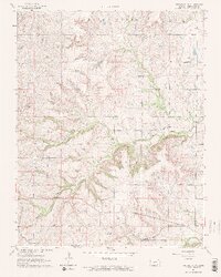
1964 Map of Piedmont NW
USGS Topo · Published 1965About this map
Otter Creek and its complex network of tributaries, including Watson Branch and North Branch Otter Creek, define the topography of this Greenwood County landscape in the mid-1960s. The region is marked by the industrial footprints of the Beaumont Oil Field and Beaumont South Oil Field, illustrating the vital role of petroleum extraction in the local economy. Transport and commerce are anchored by the St Louis San Francisco railroad, which cuts through the southern portion of the quadrangle near the settlement of Blodgett. Genealogists will find localized points of interest at the Star Cem and Piedmont Cem, while landmarks such as Temple Knob and the Community Hall provide a sense of the community's physical and social hubs during this era of photogrammetric mapping.
Find a feature on this map
20 named features on this map. Tap any name to fly to it.
Don’t see what you’re looking for? This feature index may not catch every label — zoom into the map to look around manually.
Map Details
Editions of this 1964 Piedmont NW Map
2 editions found
Other maps of this area

1885 · Eureka
USGS Topo · 1:125,000

1888 · Eureka
USGS Topo · 1:125,000

1888 · Eldorado
USGS Topo · 1:125,000

1894 · Eureka
USGS Topo · 1:125,000

1955 · Wichita
USGS Topo · 1:250,000

1958 · Wichita
USGS Topo · 1:250,000

1961 · Rosalia
USGS Topo · 1:24,000
1964 · Piedmont SW
USGS Topo · 1:24,000

1964 · Beaumont
USGS Topo · 1:24,000
1964 · Piedmont NE
USGS Topo · 1:24,000