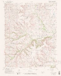
1964 Map of Piedmont NW
USGS Topo · Published 1965About this map
The headwaters of Otter Creek and its various tributaries, including Watson Branch and the North Branch Otter Creek, dominate this Greenwood County landscape in the mid-1960s. The region shows a distinct mix of ranching and early petroleum extraction, evidenced by the Beaumont Oil Field and Beaumont South Oil Field. Transportation and community life are anchored by the St Louis-San Francisco railroad line which runs through the southern portion of the map near the settlement of Blodgett. Genealogists and local historians can locate early burial sites at Star Cem and Piedmont Cem, while landmarks like the Community Hall and the elevation at Temple Knob provide clear points of reference for the era's rural layout.
Find a feature on this map
17 named features on this map. Tap any name to fly to it.
Don’t see what you’re looking for? This feature index may not catch every label — zoom into the map to look around manually.
Map Details
Editions of this 1964 Piedmont NW Map
2 editions found
Other maps of this area

1885 · Eureka
USGS Topo · 1:125,000

1888 · Eureka
USGS Topo · 1:125,000

1888 · Eldorado
USGS Topo · 1:125,000

1894 · Eureka
USGS Topo · 1:125,000

1955 · Wichita
USGS Topo · 1:250,000

1958 · Wichita
USGS Topo · 1:250,000

1961 · Rosalia
USGS Topo · 1:24,000
1964 · Piedmont SW
USGS Topo · 1:24,000

1964 · Piedmont NW
USGS Topo · 1:24,000

1964 · Beaumont
USGS Topo · 1:24,000