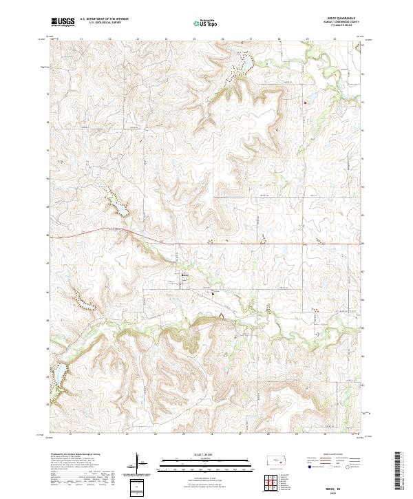
2022 Map of Reece
USGS Topo · Published 2022About this map
Reece sits as the central settlement in this portion of Greenwood County, a landscape defined by the drainage network of the West Branch Fall River and its numerous tributaries. The village is organized along 131th St and West St, while the nearby Reece Cem serves as a primary point of interest for genealogists tracing local families. The area is crisscrossed by a grid of township roads such as Twp Rd 31 and Twp Rd 43, reflecting the enduring agricultural section-line boundaries of the Kansas plains. To the north and south of the settlement, the terrain is carved by Burnt Cr and Spring Creek, showing the transition from higher rangeland down toward the river valley. The presence of Old US Hwy 54 crossing the northern part of the township highlights the historical transportation corridor that once served as a main artery through this rural region.
Find a feature on this map
47 named features on this map. Tap any name to fly to it.
Don’t see what you’re looking for? This feature index may not catch every label — zoom into the map to look around manually.
Map Details
Editions of this 2022 Reece Map
This is the sole edition of this map. No revisions or reprints were ever made.
Other maps of this area

1885 · Eureka
USGS Topo · 1:125,000

1888 · Eureka
USGS Topo · 1:125,000

1888 · Eldorado
USGS Topo · 1:125,000

1894 · Eureka
USGS Topo · 1:125,000

1955 · Wichita
USGS Topo · 1:250,000

1958 · Wichita
USGS Topo · 1:250,000

1961 · Rosalia NE
USGS Topo · 1:24,000

1961 · Rosalia
USGS Topo · 1:24,000

1964 · Piedmont NW
USGS Topo · 1:24,000

1964 · Beaumont
USGS Topo · 1:24,000