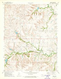
1971 Map of Reece
USGS Topo · Published 1973About this map
The Old Indian Treaty Boundary cuts through the southern reaches of this landscape, marking a significant historical line across the Kansas prairie. At the center of the survey lies Reece, a small settlement positioned along the Missouri Pacific railroad. The community is supported by the nearby Reece Cem and the surrounding Reece Oil Field, which indicates the area's mid-century reliance on petroleum extraction.
Find a feature on this map
18 named features on this map. Tap any name to fly to it.
Don’t see what you’re looking for? This feature index may not catch every label — zoom into the map to look around manually.
Map Details
Editions of this 1971 Reece Map
This is the sole edition of this map. No revisions or reprints were ever made.
Other maps of this area

1885 · Eureka
USGS Topo · 1:125,000

1888 · Eureka
USGS Topo · 1:125,000

1888 · Eldorado
USGS Topo · 1:125,000

1894 · Eureka
USGS Topo · 1:125,000

1955 · Wichita
USGS Topo · 1:250,000

1958 · Wichita
USGS Topo · 1:250,000

1961 · Rosalia NE
USGS Topo · 1:24,000

1961 · Rosalia
USGS Topo · 1:24,000

1964 · Piedmont NW
USGS Topo · 1:24,000

1964 · Beaumont
USGS Topo · 1:24,000