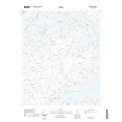
2020 Map of Reed Creek
USGS Topo · Published 2020About this map
Hartwell Lake dominates the landscape along the Georgia and South Carolina border, its intricate shoreline carving deep into the surrounding terrain near the town of Hartwell. This modern survey reveals a highly developed residential and recreational network of peninsulas, where roads like Tugaloo Heights Cir and Clearwater Shores Rd provide access to the water's edge. Despite the contemporary lakefront development, the map preserves the deeper history of the region through its numerous family and community landmarks. Researchers will find a high density of small burial grounds, such as the Cole Civil War Cem and McMullan Cem, alongside long-standing rural settlements like Reed Creek and Maretts. The transition from the agriculture-heavy uplands, marked by the headwaters of Little Lightwood Log Cr, to the leisure-oriented waterfront is punctuated by small aviation sites like Mustang Field.
Find a feature on this map
192 named features on this map. Tap any name to fly to it.
Don’t see what you’re looking for? This feature index may not catch every label — zoom into the map to look around manually.
Map Details
Editions of this 2020 Reed Creek Map
This is the sole edition of this map. No revisions or reprints were ever made.
Other maps of this area

1886 · Walhalla
USGS Topo · 1:125,000

1888 · Pickens
USGS Topo · 1:125,000

1891 · Carnesville
USGS Topo · 1:125,000

1892 · Walhalla
USGS Topo · 1:125,000

1893 · Elberton
USGS Topo · 1:125,000

1894 · Pickens
USGS Topo · 1:125,000

1896 · Walhalla
USGS Topo · 1:125,000

1950 · La France
USGS Topo · 1:24,000

1951 · La France
USGS Topo · 1:24,000

1954 · Greenville
USGS Topo · 1:250,000