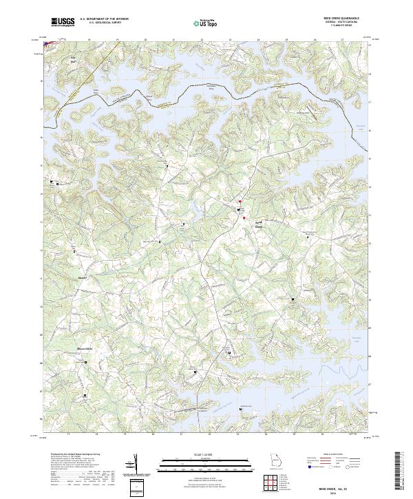
2024 Map of Reed Creek
USGS Topo · Published 2024About this map
Hartwell Lake and the Tugaloo River dominate this borderland landscape where Georgia and South Carolina meet. The terrain is defined by the dendritic fingers of the reservoir, reaching into valleys once carved by Wolf Creek and Reed Creek. Local history is deeply embedded in the rural road network, with routes like Reed Creek School Rd and Old Anderson Hwy connecting the dispersed settlements of Fair Play, Maretts, and Mount Olivet. Several historical crossing points are preserved in name, including Coles Ferry, Averys Ferry, and Chandlers Ferry, marking the era before modern bridges spanned the river. For genealogists, the map identifies numerous small burial grounds such as the Cole Civil War Cem, Robertson Cem, and New Prospect Cem, alongside established congregations like the Sharon Presbyterian Church Cem.
Find a feature on this map
62 named features on this map. Tap any name to fly to it.
Don’t see what you’re looking for? This feature index may not catch every label — zoom into the map to look around manually.
Map Details
Editions of this 2024 Reed Creek Map
This is the sole edition of this map. No revisions or reprints were ever made.
Other maps of this area

1886 · Walhalla
USGS Topo · 1:125,000

1888 · Pickens
USGS Topo · 1:125,000

1891 · Carnesville
USGS Topo · 1:125,000

1892 · Walhalla
USGS Topo · 1:125,000

1893 · Elberton
USGS Topo · 1:125,000

1894 · Pickens
USGS Topo · 1:125,000

1896 · Walhalla
USGS Topo · 1:125,000

1950 · La France
USGS Topo · 1:24,000

1951 · La France
USGS Topo · 1:24,000

1954 · Greenville
USGS Topo · 1:250,000