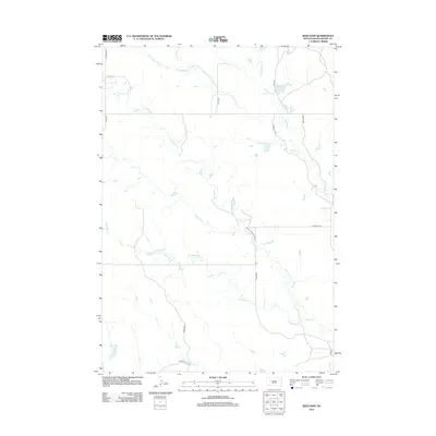
2012 Map of Reed Dam
USGS Topo · Published 2012About this map
Reed Dam anchors the landscape of this rural Meade County area, where a network of prairie drainages defines the local geography. The map reveals a complex system of watercourses including Middle Cr, Johnny Cr, and Brushy Cr, many of which feed into the primary waterways that have historically supported ranching in this part of South Dakota. The drainage patterns of W Middle Cr and Middle Brushy Cr suggest the natural erosion paths of the plains, while the small impoundment at the dam provides a vital local resource. The transportation network is primarily composed of county routes like Co HWY MC-30 and Co HWY MC-37, alongside localized tracks such as Xerxes PL and Winter Rd, illustrating the dispersed nature of high-plains settlement.
Find a feature on this map
19 named features on this map. Tap any name to fly to it.
Don’t see what you’re looking for? This feature index may not catch every label — zoom into the map to look around manually.
Map Details
Editions of this 2012 Reed Dam Map
This is the sole edition of this map. No revisions or reprints were ever made.
Other maps of this area

1953 · Rapid City
USGS Topo · 1:250,000

1957 · Rapid City
USGS Topo · 1:250,000

1983 · Lemmon Butte
USGS Topo · 1:24,000
1983 · Avance SE
USGS Topo · 1:24,000
1983 · Avance
USGS Topo · 1:24,000
1983 · Lemmon Creek
USGS Topo · 1:24,000
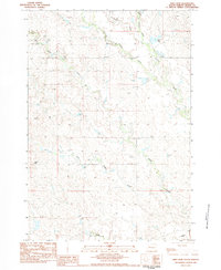
1983 · Reed Dam
USGS Topo · 1:24,000
1983 · Durkee Lake
USGS Topo · 1:24,000

1983 · Marcus
USGS Topo · 1:24,000
1983 · Opal East SE
USGS Topo · 1:24,000