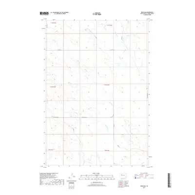
2017 Map of Reed Dam
USGS Topo · Published 2017About this map
Middle Cr and its various tributaries, including W Middle Cr, define the drainage patterns of this central Meade County landscape. The topography is etched by seasonal watercourses like Johnny Cr, Brushy Cr, and Stony Butte Cr, which converge near the northern boundary. Settlement is sparse, with the human footprint primarily visible through a grid of rural section roads and more descriptive local thoroughfares. The name United School Rd suggests a history of localized rural education that once served the families of these sprawling ranchlands. While Reed Dam stands as a focal point for water management in the northeast, much of the quadrangle remains dominated by the open terrain between Co Hwy Mc-32 and Cherry Cr to the south. This survey captures the quiet persistence of South Dakota's interior agricultural country, where landmarks are often defined by family-run operations and the essential routes that connect them.
Find a feature on this map
21 named features on this map. Tap any name to fly to it.
Don’t see what you’re looking for? This feature index may not catch every label — zoom into the map to look around manually.
Map Details
Editions of this 2017 Reed Dam Map
This is the sole edition of this map. No revisions or reprints were ever made.
Other maps of this area

1953 · Rapid City
USGS Topo · 1:250,000

1957 · Rapid City
USGS Topo · 1:250,000

1983 · Lemmon Butte
USGS Topo · 1:24,000
1983 · Avance SE
USGS Topo · 1:24,000
1983 · Avance
USGS Topo · 1:24,000
1983 · Lemmon Creek
USGS Topo · 1:24,000
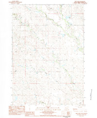
1983 · Reed Dam
USGS Topo · 1:24,000
1983 · Durkee Lake
USGS Topo · 1:24,000

1983 · Marcus
USGS Topo · 1:24,000
1983 · Opal East SE
USGS Topo · 1:24,000