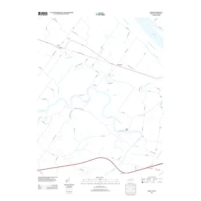
2013 Map of Reed
USGS Topo · Published 2013About this map
The Green River snakes in tight oxbows across this riverine landscape, where the confluence with the Ohio River shapes the local topography. This region is defined by an intricate drainage network of sloughs and ditches, including Richland Slough, Hurricane Slough, and Katie Meadow Slough, which speak to the low-lying, moisture-rich character of the bottomlands. Small settlements such as Reed, Newman, and Birk City are positioned along the primary transit corridors that cut through the wetlands. The road network, including the Old Hebbardsville-Coraville road and Hebbardsville Mason Landing Rd, reflects long-standing connections between riverside landings and inland farming communities. The abundance of named water features like Ipsom Ditch and Martin Cr suggests a landscape heavily modified for agriculture and water management, typical of the fertile Henderson County plains.
Find a feature on this map
69 named features on this map. Tap any name to fly to it.
Don’t see what you’re looking for? This feature index may not catch every label — zoom into the map to look around manually.
Map Details
Editions of this 2013 Reed Map
This is the sole edition of this map. No revisions or reprints were ever made.
Other maps of this area

1901 · Owensboro
USGS Topo · 1:62,500

1905 · Newburg
USGS Topo · 1:62,500

1906 · Sutherland
USGS Topo · 1:62,500

1908 · Calhoun
USGS Topo · 1:62,500

1951 · Yankeetown
USGS Topo · 1:24,000

1951 · Spottsville
USGS Topo · 1:24,000

1952 · Owensboro West
USGS Topo · 1:24,000

1952 · Newburgh
USGS Topo · 1:24,000

1952 · Reed
USGS Topo · 1:24,000
1953 · Delaware
USGS Topo · 1:24,000