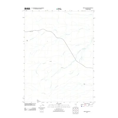
2012 Map of Reed Station
USGS Topo · Published 2012About this map
Reed Station serves as a focal point in this high-desert landscape of Elko County, where the infrastructure of ranching and water management meets the drainages of the Independence Mountains. The terrain is defined by significant elevations such as Lone Mountain, Nannies Peak, and the prominent Red Hill, which overlook a network of seasonal and perennial water sources. The importance of water in this arid environment is evident through features like Reed Reservoir, Fox Springs, and the naturally occurring Hot Spring. State Route 226 cuts a winding path through the center of the quadrangle, passing near Telegraph Flat and connecting the more isolated ranching operations like Fox Springs Ranch to the wider region. The map captures a detailed drainage system including Eagle Rock Creek, McClellan Creek, and Fordman Creek, illustrating how the local geography dictates the placement of settlements and roads.
Find a feature on this map
17 named features on this map. Tap any name to fly to it.
Don’t see what you’re looking for? This feature index may not catch every label — zoom into the map to look around manually.
Map Details
Editions of this 2012 Reed Station Map
This is the sole edition of this map. No revisions or reprints were ever made.
Other maps of this area

1955 · McDermitt
USGS Topo · 1:250,000

1955 · Wells
USGS Topo · 1:250,000

1956 · Tuscarora
USGS Topo · 1:62,500

1958 · Wells
USGS Topo · 1:250,000

1958 · Singletree Creek
USGS Topo · 1:24,000

1958 · Blue Basin
USGS Topo · 1:24,000

1959 · McDermitt
USGS Topo · 1:250,000

1961 · Wells
USGS Topo · 1:250,000

1970 · Stampede Ranch
USGS Topo · 1:24,000

1971 · Mahala Creek West
USGS Topo · 1:24,000