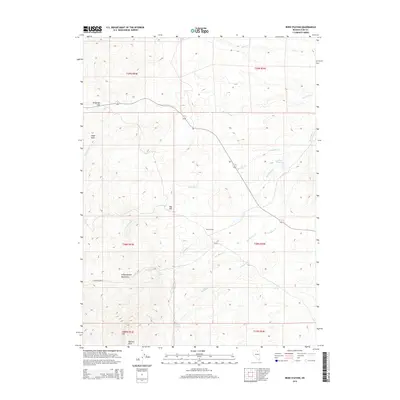
2014 Map of Reed Station
USGS Topo · Published 2014About this map
Reed Station sits at a geographic nexus in this Elko County landscape, where the foothills of the Independence Mountains meet a network of high-desert drainages. The area is defined by its water sources, from the thermal waters of Hot Spring to the cattle-country hubs of Twin Springs and Fox Springs. Traces of ranching operations are visible across the township lines, including the Stampede Rnch and infrastructure like the Reed Reservoir. The terrain transitions from the broad expanse of Telegraph Flat in the northwest to the prominent heights of Nannies Peak and Lone Mtn in the south. This 2014 survey documents the enduring character of Nevada's interior basin, where named landmarks like Eagle Rock and Red Hill have long served as navigational aids for travelers moving between the mountain ranges and the creek-fed valleys of McClellan Cr and Fordman Cr.
Find a feature on this map
25 named features on this map. Tap any name to fly to it.
Don’t see what you’re looking for? This feature index may not catch every label — zoom into the map to look around manually.
Map Details
Editions of this 2014 Reed Station Map
This is the sole edition of this map. No revisions or reprints were ever made.
Other maps of this area

1955 · McDermitt
USGS Topo · 1:250,000

1955 · Wells
USGS Topo · 1:250,000

1956 · Tuscarora
USGS Topo · 1:62,500

1958 · Wells
USGS Topo · 1:250,000

1958 · Singletree Creek
USGS Topo · 1:24,000

1958 · Blue Basin
USGS Topo · 1:24,000

1959 · McDermitt
USGS Topo · 1:250,000

1961 · Wells
USGS Topo · 1:250,000

1970 · Stampede Ranch
USGS Topo · 1:24,000

1971 · Mahala Creek West
USGS Topo · 1:24,000