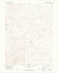
1971 Map of Reed Station
USGS Topo · Published 1974About this map
Reed Station and the surrounding high-desert range of Elko County are captured here just as modern survey methods were detailing the Great Basin's rugged interior. The eastern slopes of the Independence Mountains dominate the western half of the sheet, where peaks like Nannies Peak and Lone Mountain rise above a landscape defined by water scarcity and mineral exploration. The presence of Hot Spring and numerous unnamed springs indicates the geothermal activity of the region, while the Lone Wolf Mine and scattered prospects near McClellan Creek reflect the area's legacy of prospecting. Ranching infrastructure is visible at Fox Springs Ranch, supported by a network of unimproved routes like Fordman and various jeep trails that connect isolated water sources including Eagle Rock Reservoir and Reed Reservoir. This 1971 field-checked survey provides a clear view of the transition between the high mountain terrain and the drainage flats of Pie Creek and Rock Creek.
Find a feature on this map
28 named features on this map. Tap any name to fly to it.
Don’t see what you’re looking for? This feature index may not catch every label — zoom into the map to look around manually.
Map Details
Editions of this 1971 Reed Station Map
This is the sole edition of this map. No revisions or reprints were ever made.
Other maps of this area

1955 · McDermitt
USGS Topo · 1:250,000

1955 · Wells
USGS Topo · 1:250,000

1956 · Tuscarora
USGS Topo · 1:62,500

1958 · Wells
USGS Topo · 1:250,000

1958 · Singletree Creek
USGS Topo · 1:24,000

1958 · Blue Basin
USGS Topo · 1:24,000

1959 · McDermitt
USGS Topo · 1:250,000

1961 · Wells
USGS Topo · 1:250,000

1970 · Stampede Ranch
USGS Topo · 1:24,000

1971 · Mahala Creek West
USGS Topo · 1:24,000