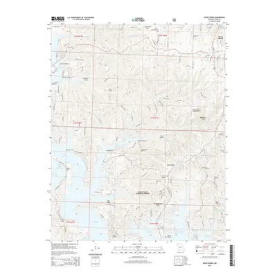
2015 Map of Reeds Spring
USGS Topo · Published 2015About this map
Table Rock Lake dominates the central and southern portion of this Missouri survey, winding through the heart of Mark Twain National Forest. The map documents a landscape of deeply cut hollows and high bluffs, including Morris Bluff and White Rock Bluff, which define the intricate shoreline of the reservoir. Settlements such as Reeds Spring, Branson West, and Kimberling City anchor the region's modern layout, while numerous smaller communities like Stoneridge are integrated into the ridge-and-valley terrain.
Find a feature on this map
116 named features on this map. Tap any name to fly to it.
Don’t see what you’re looking for? This feature index may not catch every label — zoom into the map to look around manually.
Map Details
Editions of this 2015 Reeds Spring Map
This is the sole edition of this map. No revisions or reprints were ever made.
Other maps of this area

1907 · Forsyth
USGS Topo · 1:125,000

1927 · Shell Knob
USGS Topo · 1:62,500

1942 · Aurora
USGS Topo · 1:62,500

1945 · Harrison
USGS Topo · 1:250,000

1945 · Aurora
USGS Topo · 1:62,500

1949 · Harrison
USGS Topo · 1:250,000

1950 · Shell Knob
USGS Topo · 1:62,500

1950 · Garber
USGS Topo · 1:24,000

1954 · Harrison
USGS Topo · 1:250,000

1956 · Lampe
USGS Topo · 1:24,000