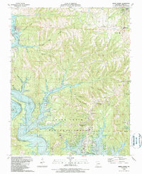
1989 Map of Reeds Spring
USGS Topo · Published 1989About this map
Table Rock Lake dominates this landscape, its serpentine fingers reaching deep into the forested Ozark hills where the James River and Flat Creek meet. The 1989 topography reveals a region defined by recreational development and conservation, with significant acreage belonging to the Mark Twain National Forest. Local history is preserved in the numerous family cemeteries and small rural congregations, such as Yocum Pond Cem and the Allen Ch, scattered among the hollows. To the north, Reeds Spring serves as a hub, featuring the Reeds Spring Sch and Omar Gibson Vo Tech Sch. The map also captures the distinct geological character of the area, noting the Talking Rocks Cavern and prominent bluffs like Oswalt Bluff, illustrating how the karst terrain has shaped both the natural environment and local tourism.
Find a feature on this map
61 named features on this map. Tap any name to fly to it.
Don’t see what you’re looking for? This feature index may not catch every label — zoom into the map to look around manually.
Map Details
Editions of this 1989 Reeds Spring Map
This is the sole edition of this map. No revisions or reprints were ever made.
Other maps of this area

1907 · Forsyth
USGS Topo · 1:125,000

1927 · Shell Knob
USGS Topo · 1:62,500

1942 · Aurora
USGS Topo · 1:62,500

1945 · Harrison
USGS Topo · 1:250,000

1945 · Aurora
USGS Topo · 1:62,500

1949 · Harrison
USGS Topo · 1:250,000

1950 · Shell Knob
USGS Topo · 1:62,500

1950 · Garber
USGS Topo · 1:24,000

1954 · Harrison
USGS Topo · 1:250,000

1956 · Lampe
USGS Topo · 1:24,000