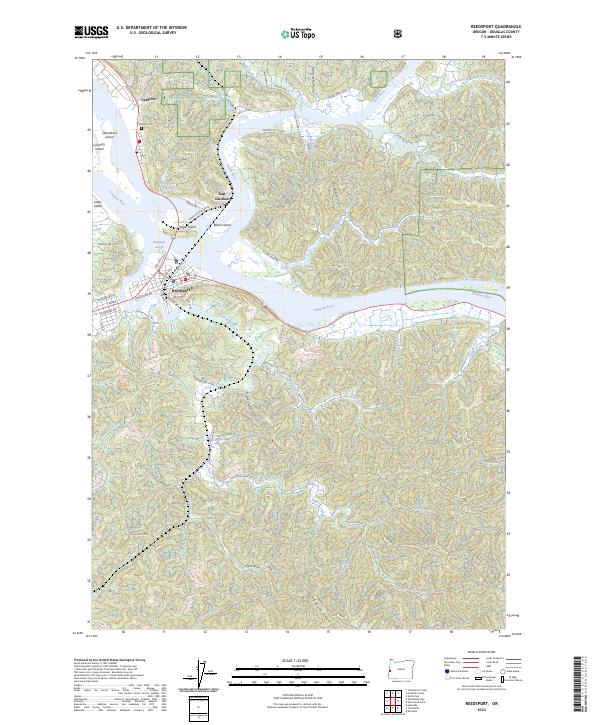
2024 Map of Reedsport
USGS Topo · Published 2024About this map
The confluence of the Umpqua River and Smith River anchors this coastal landscape, where the settlements of Gardiner and East Gardiner sit opposite the town of Reedsport. The map details a complex network of waterways, including McIntosh Slough and Hinsdale Slough, which weave through numerous islands like Bolon Island and Leeds Island. Above the riverfront, the terrain rises into the Siuslaw National Forest, containing the protected reaches of the Devil's Staircase Wilderness.
Find a feature on this map
73 named features on this map. Tap any name to fly to it.
Don’t see what you’re looking for? This feature index may not catch every label — zoom into the map to look around manually.
Map Details
Editions of this 2024 Reedsport Map
This is the sole edition of this map. No revisions or reprints were ever made.
Other maps of this area

1919 · Earl
USGS Topo · 1:48,000

1920 · Siltcoos Lake
USGS Topo · 1:62,500

1923 · Reedsport
USGS Topo · 1:62,500

1941 · Siltcoos Lake
USGS Topo · 1:62,500

1942 · Siltcoos Lake
USGS Topo · 1:62,500

1942 · Reedsport
USGS Topo · 1:62,500

1943 · Goodwin Peak
USGS Topo · 1:62,500

1954 · Coos Bay
USGS Topo · 1:250,000

1955 · Scottsburg
USGS Topo · 1:62,500
1956 · Reedsport
USGS Topo · 1:62,500