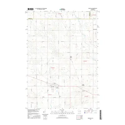
2015 Map of Reedsville
USGS Topo · Published 2015About this map
Reedsville serves as a central hub in this agricultural landscape on the border of Brown and Manitowoc counties. The village is surrounded by several smaller crossroad communities, including Maple Grove and Menchalville, which reflect the dense rural settlement patterns of eastern Wisconsin. Numerous local burial grounds, such as Saint Mary's Cem and the Saint John - Saint James Lutheran Cem, indicate the long-standing community centers and parochial roots established here. The land is drained by the winding Mud Creek and the Branch River, which cut through a grid of country roads like Co Rd W and Man Cal Rd. This network of farm-to-market routes connects the outlying hamlets of Grimms and North Grimms, illustrating how the region's geography remained closely tied to its 19th-century township and range origins well into the modern era.
Find a feature on this map
75 named features on this map. Tap any name to fly to it.
Don’t see what you’re looking for? This feature index may not catch every label — zoom into the map to look around manually.
Map Details
Editions of this 2015 Reedsville Map
This is the sole edition of this map. No revisions or reprints were ever made.
Other maps of this area

1954 · De Pere
USGS Topo · 1:62,500

1954 · Denmark
USGS Topo · 1:62,500

1954 · Chilton
USGS Topo · 1:62,500

1954 · Reedsville
USGS Topo · 1:62,500

1954 · Manitowoc
USGS Topo · 1:250,000

1955 · Green Bay
USGS Topo · 1:250,000

1958 · Manitowoc
USGS Topo · 1:250,000

1974 · Brillion
USGS Topo · 1:24,000
1974 · Potter
USGS Topo · 1:24,000

1974 · Greenleaf
USGS Topo · 1:24,000