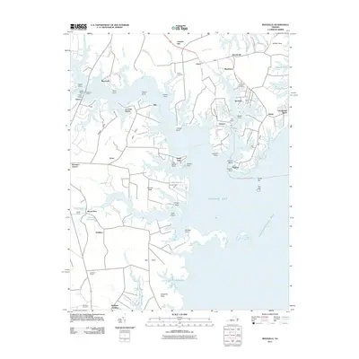
2011 Map of Reedville
USGS Topo · Published 2011About this map
The Great Wicomico River defines this portion of the Northern Neck, where deeply indented shorelines and numerous necks create a complex geography of maritime settlements. In the early 21st century, Reedville remains a focal point for the region's fishing heritage, situated on a narrow peninsula between Cockrell Creek and the Chesapeake Bay. The land is fragmented into distinctive landforms such as Harveys Neck, Ball Neck, and Hughletts Neck, which have shaped local transportation and settlement patterns for generations.
Find a feature on this map
94 named features on this map. Tap any name to fly to it.
Don’t see what you’re looking for? This feature index may not catch every label — zoom into the map to look around manually.
Map Details
Editions of this 2011 Reedville Map
This is the sole edition of this map. No revisions or reprints were ever made.
Other maps of this area

1916 · Kilmarnock
USGS Topo · 1:48,000

1917 · Heathsville
USGS Topo · 1:48,000

1917 · Kilmarnock
USGS Topo · 1:62,500

1917 · Ewell
USGS Topo · 1:62,500

1942 · Kilmarnock
USGS Topo · 1:62,500

1943 · Richmond
USGS Topo · 1:250,000
1944 · Sunnybank
USGS Topo · 1:31,680

1944 · Reedville
USGS Topo · 1:31,680
1944 · Heathsville
USGS Topo · 1:31,680
1949 · Irvington
USGS Topo · 1:24,000