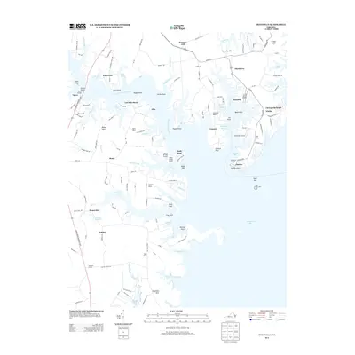
2013 Map of Reedville
USGS Topo · Published 2013About this map
Reedville and its surrounding water-bound necks define this 2013 snapshot of Virginia's Northern Neck. The landscape is deeply etched by the Great Wicomico River and numerous tidal creeks, where maritime life centers on Cockrell Creek and the waterfront settlements of Fleeton and Fairport. Inland, the map documents a series of rural hamlets and agricultural landmarks, including Mount Olive and Rehoboth Church.
Find a feature on this map
131 named features on this map. Tap any name to fly to it.
Don’t see what you’re looking for? This feature index may not catch every label — zoom into the map to look around manually.
Map Details
Editions of this 2013 Reedville Map
This is the sole edition of this map. No revisions or reprints were ever made.
Other maps of this area

1916 · Kilmarnock
USGS Topo · 1:48,000

1917 · Heathsville
USGS Topo · 1:48,000

1917 · Kilmarnock
USGS Topo · 1:62,500

1917 · Ewell
USGS Topo · 1:62,500

1942 · Kilmarnock
USGS Topo · 1:62,500

1943 · Richmond
USGS Topo · 1:250,000
1944 · Sunnybank
USGS Topo · 1:31,680

1944 · Reedville
USGS Topo · 1:31,680
1944 · Heathsville
USGS Topo · 1:31,680
1949 · Irvington
USGS Topo · 1:24,000