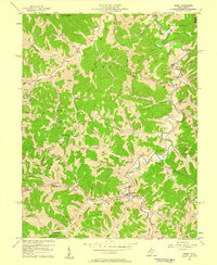
1957 Map of Reedy
USGS Topo · Published 1959About this map
The Baltimore and Ohio rail line tracks the winding course of Reedy Creek in this 1957 study of Roane and Wirt Counties. The landscape is defined by the extensive Gas Field development of the era, with numerous wells and a Compressor Sta peppered among the narrow valleys. This energy infrastructure coexists with a dense network of small rural settlements and community landmarks, including Zackville, Peewee, and Dukes.
Find a feature on this map
72 named features on this map. Tap any name to fly to it.
Don’t see what you’re looking for? This feature index may not catch every label — zoom into the map to look around manually.
Map Details
Editions of this 1957 Reedy Map
2 editions found
Other maps of this area

1906 · Elizabeth
USGS Topo · 1:62,500

1906 · Belleville
USGS Topo · 1:62,500

1907 · Spencer
USGS Topo · 1:62,500

1907 · Ripley
USGS Topo · 1:62,500

1924 · Belleville
USGS Topo · 1:62,500

1924 · Elizabeth
USGS Topo · 1:62,500

1926 · Elizabeth
USGS Topo · 1:62,500

1926 · Belleville
USGS Topo · 1:62,500

1926 · Ripley
USGS Topo · 1:62,500

1928 · Spencer
USGS Topo · 1:62,500