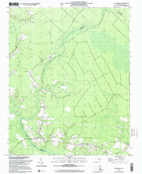
2000 Map of Reelsboro
USGS Topo · Published 2001About this map
Upper Broad Creek defines the low-lying geography of this coastal plain region at the turn of the 21st century, where the boundaries of Pamlico and Craven counties meet. The landscape is a dense network of hydrologic features including Pine Tree Swamp, Morgan Swamp, and the interestingly named Possum Savannah Swamp. These wetlands dictate the placement of small rural settlements like Reelsboro, Olympia, and Spring Hope, which are interconnected by a grid of secondary roads and local routes such as Duffy Road and Brinson Road.
Find a feature on this map
28 named features on this map. Tap any name to fly to it.
Don’t see what you’re looking for? This feature index may not catch every label — zoom into the map to look around manually.
Map Details
Editions of this 2000 Reelsboro Map
This is the sole edition of this map. No revisions or reprints were ever made.
Other maps of this area

1901 · New Bern
USGS Topo · 1:62,500

1902 · Vanceboro
USGS Topo · 1:62,500

1903 · New Bern
USGS Topo · 1:62,500

1904 · Vanceboro
USGS Topo · 1:62,500

1905 · Vanceboro
USGS Topo · 1:62,500

1950 · New Bern
USGS Topo · 1:24,000

1950 · Aurora
USGS Topo · 1:24,000

1950 · Edward
USGS Topo · 1:24,000

1950 · Upper Broad Creek
USGS Topo · 1:24,000

1950 · Arapahoe
USGS Topo · 1:24,000