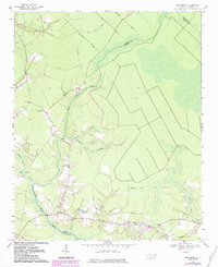
1969 Map of Reelsboro
USGS Topo · Published 1983About this map
Upper Broad Creek and its complex network of tributaries define this coastal plain landscape at the boundary of Pamlico and Craven counties. The settlement of Reelsboro serves as a local hub near the southern edge, while the small communities of Spring Hope and Olympia are linked by a series of rural routes including Casey Road and Brinson Road. This 1969 field-checked survey reveals an environment where agriculture and timber management intersect with extensive wetlands, such as Possum Swamp and Savannah Bridge Swamp. The presence of numerous small family or community burial sites, including Pipkin No 2 and Hollywood Cem, alongside the Spring Hope Ch, offers significant geographic data for genealogists tracing the distribution of residents across this low-lying terrain. To the north, the elevated ground of Stair Ridge provides a distinct contrast to the surrounding swamps and branches.
Find a feature on this map
33 named features on this map. Tap any name to fly to it.
Don’t see what you’re looking for? This feature index may not catch every label — zoom into the map to look around manually.
Map Details
Editions of this 1969 Reelsboro Map
3 editions found
Other maps of this area

1901 · New Bern
USGS Topo · 1:62,500

1902 · Vanceboro
USGS Topo · 1:62,500

1903 · New Bern
USGS Topo · 1:62,500

1904 · Vanceboro
USGS Topo · 1:62,500

1905 · Vanceboro
USGS Topo · 1:62,500

1950 · New Bern
USGS Topo · 1:24,000

1950 · Aurora
USGS Topo · 1:24,000

1950 · Edward
USGS Topo · 1:24,000

1950 · Upper Broad Creek
USGS Topo · 1:24,000

1950 · Arapahoe
USGS Topo · 1:24,000