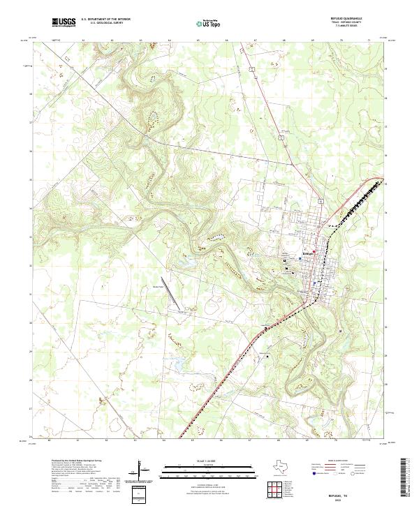
2022 Map of Refugio
USGS Topo · Published 2022About this map
The town of Refugio serves as the focal point of this coastal plains landscape, situated at a strategic bend where the Mission River meets the local creek systems. The community's historical development is evident in the concentration of civic and spiritual sites near the town center, including the Refugio County Courthouse and a cluster of burial grounds such as the Refugio Community Cem and Holy Cross Cem. The surrounding environment is defined by the winding paths of Blanco Cr, Medio Cr, and Dry Cr, which create a series of oxbow lakes and wetlands like Butte Lake and Dyck Lake. These water features, combined with named landmarks like Rooke Field and Rooke Lake, illustrate a landscape shaped by both the river's hydrology and large-scale ranching or agricultural holdings typical of this region of Texas. The network of rural roads and residential streets, such as Alamo St and Crockett Rd, further reveals the town's established grid and its connections to the broader plains.
Find a feature on this map
67 named features on this map. Tap any name to fly to it.
Don’t see what you’re looking for? This feature index may not catch every label — zoom into the map to look around manually.
Map Details
Editions of this 2022 Refugio Map
This is the sole edition of this map. No revisions or reprints were ever made.
Other maps of this area

1953 · Beeville
USGS Topo · 1:250,000

1954 · Rockport
USGS Topo · 1:62,500

1954 · Woodsboro
USGS Topo · 1:62,500

1954 · Vidaurri
USGS Topo · 1:62,500

1954 · Refugio
USGS Topo · 1:62,500

1956 · Beeville
USGS Topo · 1:250,000

1960 · Beeville
USGS Topo · 1:250,000

1978 · Woodsboro
USGS Topo · 1:24,000

1978 · Ryanville
USGS Topo · 1:24,000

1978 · Vidaurri
USGS Topo · 1:24,000