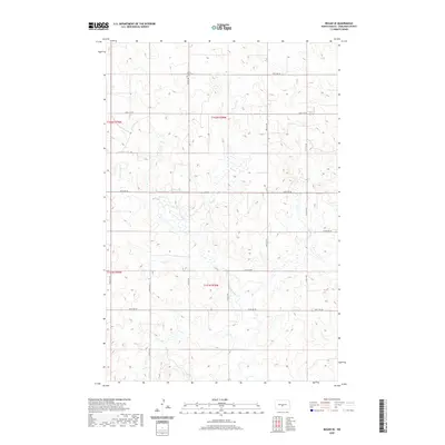
2020 Map of Regan SE
USGS Topo · Published 2020About this map
Ghylin Union Cem stands as a focal point for family history in this corner of the Missouri Plateau, located in the northern reaches of the quadrangle. The landscape is defined by the winding course of the W Br Apple Cr, which drainage system meanders through a series of shallow depressions and prairie potholes characteristic of this region's glacial history.
Find a feature on this map
18 named features on this map. Tap any name to fly to it.
Don’t see what you’re looking for? This feature index may not catch every label — zoom into the map to look around manually.
Map Details
Editions of this 2020 Regan SE Map
This is the sole edition of this map. No revisions or reprints were ever made.
Other maps of this area

1907 · Bismarck
USGS Topo · 1:125,000

1951 · Menoken
USGS Topo · 1:62,500

1951 · McKenzie
USGS Topo · 1:62,500

1954 · Bismarck
USGS Topo · 1:250,000

1954 · McClusky
USGS Topo · 1:250,000

1958 · Bismarck
USGS Topo · 1:250,000

1958 · McClusky
USGS Topo · 1:250,000
1975 · Solberg Butte
USGS Topo · 1:24,000
1975 · McKenzie NW
USGS Topo · 1:24,000
1975 · Keever Butte
USGS Topo · 1:24,000