
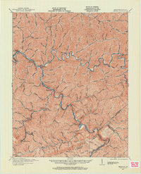
1915 Map of Regina
USGS Topo · Published 1915About this map
The Levisa Fork Big Sandy River and its numerous tributaries carve a dense network of hollows through Pike County during this mid-1910s survey. This era of the Appalachian coalfields is marked by small settlements and post offices positioned at river junctions and along the rail lines. Shelbiana P.O. and Sutton P.O. Ward serve as local hubs, while Millard P.O. The Forks indicates the geographic convergence of the regional waterways. The C & O Ry follows the riverbank, providing the critical infrastructure for the industrial growth of towns like Elkhorn City and Praise P.O. at the southern edge of the sheet.
Find a feature on this map
41 named features on this map. Tap any name to fly to it.
Don’t see what you’re looking for? This feature index may not catch every label — zoom into the map to look around manually.
Map Details
Editions of this 1915 Regina Map
2 editions found
Other maps of this area

1886 · Prestonsburg
USGS Topo · 1:125,000

1886 · Grundy
USGS Topo · 1:125,000

1887 · Warfield
USGS Topo · 1:125,000

1890 · Whitesburg
USGS Topo · 1:125,000

1890 · Grundy
USGS Topo · 1:125,000

1891 · Warfield
USGS Topo · 1:125,000

1892 · Grundy
USGS Topo · 1:125,000

1892 · Whitesburg
USGS Topo · 1:125,000

1892 · Prestonsburg
USGS Topo · 1:125,000

1909 · Matewan
USGS Topo · 1:48,000