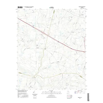
2017 Map of Register
USGS Topo · Published 2017About this map
Canoochee River and its various tributaries, such as Tenmile Cr and Bad Prong, define the drainage of this Bulloch County landscape. Small rural communities like Register, Excelsior, New Hope, and Adabelle are connected by a network of local roads and family-named landmarks. The area is marked by numerous agricultural ponds and private lakes, including the substantial Great Southern Paper Company Lake in the southwest corner. For genealogists, the map identifies several local burial grounds such as Saint Pauls Cem, Bowen-Dekle Cem, and Easons Chapel Cem. Several bridges across the river and creeks, notably Mike Kennedy Bridge and Kennedy Bridge, indicate historical crossing points that have likely served these farming communities for generations. The land use remains primarily agricultural and timber-focused, reflecting the traditional economy of this Georgia coastal plain region.
Find a feature on this map
111 named features on this map. Tap any name to fly to it.
Don’t see what you’re looking for? This feature index may not catch every label — zoom into the map to look around manually.
Map Details
Editions of this 2017 Register Map
This is the sole edition of this map. No revisions or reprints were ever made.
Other maps of this area

1919 · Claxton
USGS Topo · 1:62,500

1920 · Statesboro
USGS Topo · 1:62,500

1943 · Statesboro
USGS Topo · 1:62,500

1944 · Claxton
USGS Topo · 1:62,500

1947 · Savannah
USGS Topo · 1:250,000

1948 · Savannah
USGS Topo · 1:250,000

1950 · Claxton
USGS Topo · 1:62,500

1957 · Macon
USGS Topo · 1:250,000

1957 · Savannah
USGS Topo · 1:250,000

1958 · Macon
USGS Topo · 1:250,000