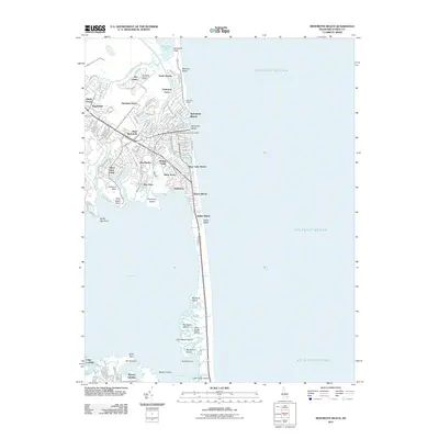
2011 Map of Rehoboth Beach
USGS Topo · Published 2011About this map
Rehoboth Beach and its surrounding coastal communities are shown in this 2011 survey, illustrating a dense network of residential streets and shoreline developments. The layout reveals the established character of Henlopen Acres and North Shores to the north, while the core of the city is anchored by the Rehoboth Beach Post Office and the prominent Silver Lake. The map details the thin barrier between the Atlantic Ocean and the sprawling waters of Rehoboth Bay, a geography that defines the local economy and settlement patterns.
Find a feature on this map
125 named features on this map. Tap any name to fly to it.
Don’t see what you’re looking for? This feature index may not catch every label — zoom into the map to look around manually.
Map Details
Editions of this 2011 Rehoboth Beach Map
This is the sole edition of this map. No revisions or reprints were ever made.
Other maps of this area

1888 · Cape May
USGS Topo · 1:62,500

1893 · Cape May
USGS Topo · 1:62,500

1898 · Cape May
USGS Topo · 1:62,500

1918 · Rehoboth
USGS Topo · 1:62,500

1918 · Cape Henlopen
USGS Topo · 1:62,500

1918 · Cape May
USGS Topo · 1:62,500

1925 · Cape May
USGS Topo · 1:62,500

1937 · Cape Henlopen
USGS Topo · 1:62,500

1938 · Rehoboth
USGS Topo · 1:62,500
1940 · Cape May
USGS Topo · 1:62,500