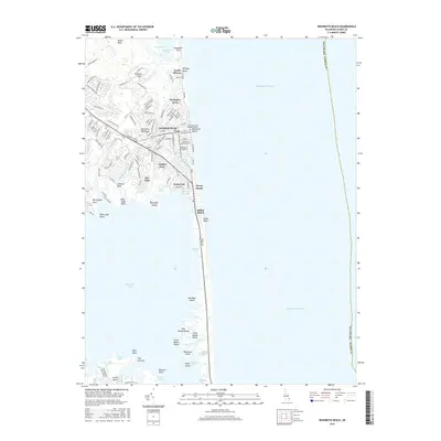
2016 Map of Rehoboth Beach
USGS Topo · Published 2016About this map
Rehoboth Beach serves as the central hub of this coastal survey, showing the dense grid of vacation-oriented streets and the Wilmington Coll Rehoboth Beach landmark. The landscape is defined by the thin barrier of land between the Atlantic Ocean and the sprawling waters of Rehoboth Bay. To the north, the protected waters of Gordon Pond sit near the residential enclaves of North Shores and Henlopen Acres.
Find a feature on this map
127 named features on this map. Tap any name to fly to it.
Don’t see what you’re looking for? This feature index may not catch every label — zoom into the map to look around manually.
Map Details
Editions of this 2016 Rehoboth Beach Map
This is the sole edition of this map. No revisions or reprints were ever made.
Other maps of this area

1888 · Cape May
USGS Topo · 1:62,500

1893 · Cape May
USGS Topo · 1:62,500

1898 · Cape May
USGS Topo · 1:62,500

1918 · Rehoboth
USGS Topo · 1:62,500

1918 · Cape Henlopen
USGS Topo · 1:62,500

1918 · Cape May
USGS Topo · 1:62,500

1925 · Cape May
USGS Topo · 1:62,500

1937 · Cape Henlopen
USGS Topo · 1:62,500

1938 · Rehoboth
USGS Topo · 1:62,500
1940 · Cape May
USGS Topo · 1:62,500