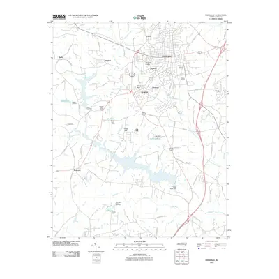
2010 Map of Reidsville
USGS Topo · Published 2010About this map
Reidsville serves as the focal point of this 2010 survey, showing the city's residential expansion into neighborhoods like Womack Courts, Courtland Park, and Woodland Park. The landscape is defined by its water management systems, notably the Reidsville Water Supply Dam and several private impoundments including Washburns Lake and Clarks Lake. These features, alongside the Haw River and Troublesome Creek, illustrate the historical importance of water resources to the region's development.
Find a feature on this map
90 named features on this map. Tap any name to fly to it.
Don’t see what you’re looking for? This feature index may not catch every label — zoom into the map to look around manually.
Map Details
Editions of this 2010 Reidsville Map
This is the sole edition of this map. No revisions or reprints were ever made.
Other maps of this area

1951 · Lake Brandt
USGS Topo · 1:24,000

1951 · Browns Summit
USGS Topo · 1:24,000

1953 · Greensboro
USGS Topo · 1:250,000

1954 · Greensboro
USGS Topo · 1:250,000

1962 · Greensboro
USGS Topo · 1:250,000

1966 · Greensboro
USGS Topo · 1:250,000

1970 · Ossipee
USGS Topo · 1:24,000
1971 · Southeast Eden
USGS Topo · 1:24,000
1971 · Ruffin
USGS Topo · 1:24,000
1971 · Bethany
USGS Topo · 1:24,000