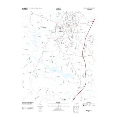
2013 Map of Reidsville
USGS Topo · Published 2013About this map
Lake Reidsville serves as a major focal point in this Rockingham County landscape, surrounded by residential developments such as Forest Hills and Oak Hills. The 2013 survey illustrates a transition from the urban grid of the northern town center toward the sprawling southern water features and timbered tracts. The headwaters of the Haw River flow through the southern portion of the quadrangle, where specialized sites like Chinqua-Penn Camp and Gullrock Camp occupy the lakefront and riverbanks.
Find a feature on this map
278 named features on this map. Tap any name to fly to it.
Don’t see what you’re looking for? This feature index may not catch every label — zoom into the map to look around manually.
Map Details
Editions of this 2013 Reidsville Map
This is the sole edition of this map. No revisions or reprints were ever made.
Other maps of this area

1951 · Lake Brandt
USGS Topo · 1:24,000

1951 · Browns Summit
USGS Topo · 1:24,000

1953 · Greensboro
USGS Topo · 1:250,000

1954 · Greensboro
USGS Topo · 1:250,000

1962 · Greensboro
USGS Topo · 1:250,000

1966 · Greensboro
USGS Topo · 1:250,000

1970 · Ossipee
USGS Topo · 1:24,000
1971 · Southeast Eden
USGS Topo · 1:24,000
1971 · Ruffin
USGS Topo · 1:24,000
1971 · Bethany
USGS Topo · 1:24,000